Hiking Bowfell via Angle Tarn | Guide
A guide to exploring the Lake District’s Bowfell and Langdales
Nestled amidst Langdale Valley lies Bowfell, a fell admired by adventurers seeking solitude and scenic splendour. Bowfell is the sixth highest mountain in the Lakes at 902 meters tall and provides incredible 360-degree views of the central fells, Lake Windermere and Sca Fell.
Whether you're a seasoned hiker or visiting for the summer, the Bowfell hike is a great walk for hikers and a great Wainwright to tick off.
Total Distance: 14km
Location: The route starts and ends by the Old Dungeon Ghyll in Great Langdale
Where to stay: There are plenty of campsites nearby and the villages of Elterwater and Chapel Stile have great places to stay

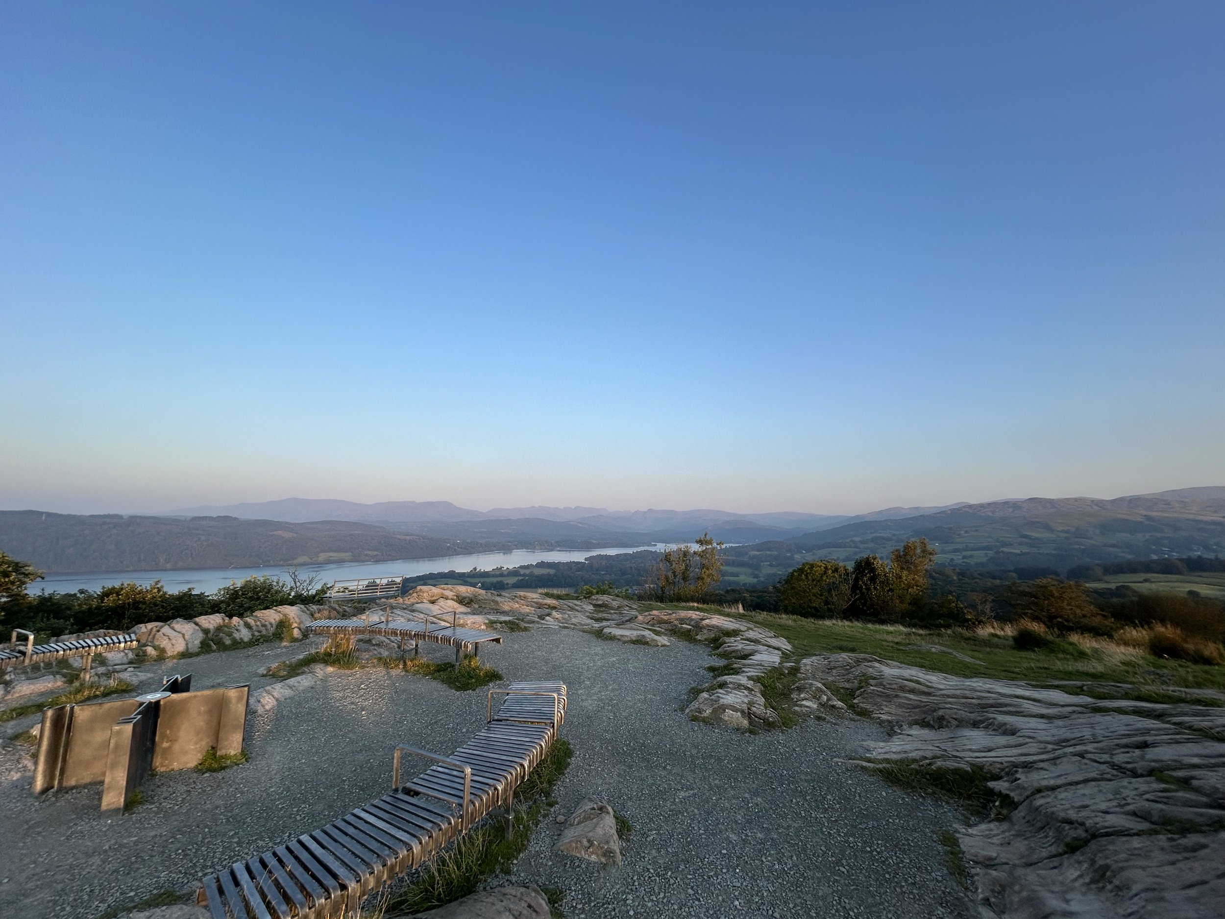
A view from Bowfell looking over the Southern Lakes
The Bowfell Walking Route

Map of Bowfell hiking route
Begin your walk from the National Trust car park next to the Old Dungeon Ghyll Hotel (LA22 9JY). Cross the bridge over Great Langdale Beck and follow the track leading to Stool End farm.
Ascending The Band: Traverse along The Band, where the path gradually becomes rockier as you ascend. Make sure to take a breather and look back down the valley at the incredible views. Despite the rugged terrain, there are no significant difficulties, and soon you'll find yourself surrounded by boulder fields as you approach the upper section of The Band.
Summit Views: Upon reaching the summit, immerse yourself in the breathtaking vistas stretching in every direction. Be prepared for strong winds from all directions and a little scrambling to get to the very top.
Descent via Ore Gap: Once you’ve taken in the views, navigate your descent following a line of cairns north, towards Ore Gap. The path isn’t clear here and can be tricky to navigate in bad weather.
Route towards Angle Tarn: You have two options here. You can either descend towards Angle Tarn, via a slightly steep by manageable path or head up towards Esk Pike and tick off another Wainwright before making you way back down to Angle Tarn.
The Route Down: Once at Angle Tarn, cross the stream over the stepping stones and head towards Rossett Gill. While the direct path down Rossett Gill may appeal to the adventurous, opt for the old pony route for a more manageable descent. Follow the relatively easy gradient of the old pony route, offering superb views along Mickleden valley. Navigate through rocky sections until the path eventually merges with Rossett Gill further down.
Return Journey along the Cumbria Way: As you reach Mickleden, join the Cumbria Way, marking the beginning of your easy descent back to the valley floor. Follow the path along the valley, back to Old Dungeion Ghyll for hearty pub grub and a drink.


Things to plan
As with any fell walk, it's important to plan ahead and be prepared for the conditions. Bowfell is a challenging walk in places that requires a good level of fitness, but the route is fairly straightforward with limited scrambles if you stick to the main route. Check the weather forecast before setting off, and be prepared for changes in weather conditions.
It's also essential to bring plenty of food and water, as well as appropriate clothing and footwear. Sturdy walking boots with good ankle support are a must, and it's recommended to bring a waterproof jacket and trousers, warm layers, and a hat and gloves. Sunscreen, a map and a compass are also essential items to bring.
Hey, quick note
I’ve been working hard on a new Lake District Guide and Digital Map to help you plan your next Lake District trip. It includes walks, restaurants, waterfalls, places to stay and places to visit. Check out the full guide and map here.
The start of the Bowfell hike
Location
Bowfell is located at the end of the Langdale Valley in the heart of the Lake District National Park, England. The nearest town is Ambleside which about a 20 minute drive away, which is a popular base for exploring the area. There are many places to stay in Ambleside, Elterwater, Grasemere and Windermere, including hotels, B&Bs, self-catering cottages and campsites.
Getting to Ambleside is relatively easy, with good road and bus routes. The nearest train station is Windermere, which is a short bus or taxi ride away. To get to the start of the Bowfell hike, you’ll ideally need your own car as there are no bus routes that run.

Panoramic view from Bowfell
Kit list for when out walking in the Lake District
As mentioned, it's essential to bring appropriate clothing and footwear for your hike. Here's a list of essential items to bring:
Sturdy walking boots and socks with good ankle support
You can get a decent pair of boots from Cotswold Outdoors, Mountain Warehouse or Blacks. You don’t need to spend a load of money, but anything with ankle support should do the job. I have the Scarpa Rush TRK Gore-Tex boots and they are fantastic!
Hiking socks: I personally use Smartwool merino wool socks which are incredibly comfy, help keep my feet dry
Daypack: when out walking in the Lakes, I always take my Osprey Talon 44L bag. I recommend the Osprey daypacks such as the Talon range for men and Tempest range for woman.
Waterproof jacket and trousers - even in the summer, taking a waterproof jacket that offers protection from the wind is key
You don’t need to spend a lot of money, but if you are going to be hiking often then investing in a good waterproof may be a good idea
Warm layers
Fleece - My go-to warm layer - Patagonia R1 Fleece
Warm gloves or mittens: I personally use the Rab Mens Pivot GTX Gloves and these worked well on my recent winter hiking trips.
Lightweight Gloves: For lower hills I recommend lightweight, fleece or quick drying fabric gloves. I personally use the Sealskinz unisex waterproof gloves if it is raining and the Montane Prism gloves if it is dry but windy (they are lighter and a little more comfy.
Neck bandana or scarf: For the chilly days on the mountain, I recommend bringing a neck gaiter or bandana. I recommend the Buff unisex bandana.
Map and compass (and the ability to use them)
Trekking poles: Trekking poles can reduce the impact on your joints by up to 20%. I recommend adjustable Black Diamond or Leki trekking poles
Food and water
Kendal Mint Cake is my favourite snack for any walk and is a famous snack still made in the Lake District
Water bladder / bottles: When out in the fells, I aim to drink at least 1L of water. I recommend the Osprey 2 litre water badder which can be used in most backpacks.
Sunscreen and Bug Spray
First aid kit - a small mix of plasters, Savalon (for bites and stings) and antiseptic wipes will do
Head torch: You will need a head torch with a decent power for any trips to the loo and more importantly the summit hike. I personally use a Petzl ACTIK® 600 CORE which is affordable and has a decent battery life. You’ll also need spare batteries as the cold will drain them quicker.
Mobile phone (with a full battery) + portable charger.
I recommend any Anker Power Bank as they are reliable and well made. I use the USB-C 10,000 maH with 20W model. It charges my phone and watch when wild camping and is a great lightweight option

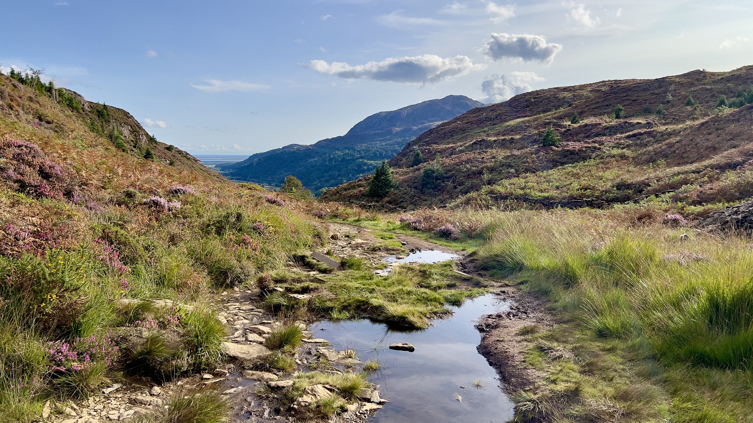
View over the Langdales
Final Thoughts
Bowfell is an incredible walk with decent views and scrambles along the way. It is challenging in parts but rewarding with its 360-degree views of the surrounding fells. With proper planning and preparation, it's an achievable goal for most walkers.